

New research indicates that the threat of rising sea levels and coastal inundation is significantly more severe than previously understood, with millions more people at imminent risk than current projections suggest. Two comprehensive studies, one focusing on actual sea level measurements and the other on land subsidence in global river deltas, reveal critical flaws in existing methodologies, leading to a widespread underestimation of coastal vulnerability. These findings necessitate an urgent reassessment of flood-risk forecasts and adaptation strategies, particularly for low-lying megacities and vulnerable regions in the Global South.
Underestimated Seas: A Higher Baseline for a Growing Threat
For decades, global flood-risk assessments have largely relied on sophisticated but generalized models of the Earth’s geoid – its theoretical shape determined by gravity and rotation. However, a groundbreaking Dutch analysis of real-world tidal gauge data has challenged the accuracy of these models, revealing that actual sea levels are, on average, nearly a foot higher than standard estimates. Katharina Seeger and Philip Minderhoud, geographers at Wageningen University & Research in the Netherlands, found that nearly all scientific literature has dramatically underestimated current sea levels.
"The impacts of sea level rise under climate change have been systematically underestimated," stated Matt Palmer, a specialist on sea level rise at the U.K. Met Office’s Hadley Centre for Climate Science. "We could see devastating impacts much earlier than predicted – particularly in the Global South."
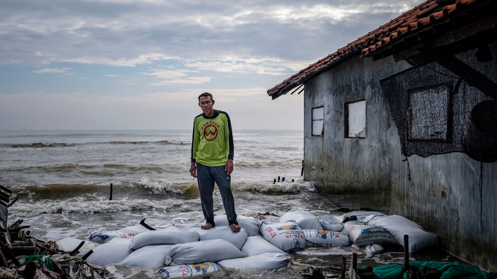
The Dutch study, which examined 385 locations worldwide, found discrepancies of three feet or more in many previously accepted sea level measurements, with most estimates being too low. This suggests that approximately 80 million people are currently living on coastal land below sea level, a figure nearly double previous estimates. This higher baseline means that future sea level rise will accelerate the timeline for inundation in many areas, potentially by several decades. Policymakers and international funding bodies like the World Bank, which depend on these scientific assessments for planning and resource allocation, may be operating with significantly outdated information.
Seeger explained that a primary issue lies in the methodology. "More than 90 percent of local studies estimating current sea levels and future rises cut-and-paste the results of mathematical models of the ‘geoid’," she said. These models, while useful for broad approximations, assume calm and uniform oceans, thereby ignoring crucial local ocean dynamics such as currents, thermal expansion of water due to elevated temperatures, and the accumulation of water along coastlines driven by prevailing winds.
Jonathan Bamber, a glaciologist at the University of Bristol, noted that this discrepancy between model-based estimates and actual measurements "exceeds total global sea level rise since the start of the 20th century."
The research also highlights significant regional variations. Higher-than-expected sea levels are most pronounced in the Global South, where ocean dynamics are generally more intense. Coasts in Southeast Asia, for example, are experiencing tides that are up to three feet higher than geoid modeling predicts. Conversely, only a few areas, such as parts of Antarctica and the northern Mediterranean, show lower actual sea levels compared to model predictions.
"Our corrected calculations reveal that up to 37 percent more area and up to 68 percent more people will fall below sea level following [3.3 feet] of sea level rise," Seeger elaborated. This translates to an additional area at risk of inundation roughly the size of the United Kingdom, affecting 132 million people – a population comparable to that of Mexico.
Seeger suggested that this "methodological blind spot" may have persisted because geoid estimates tend to be more accurate in regions like Europe and the Eastern Seaboard of North America, where a larger proportion of published research originates. While the higher current sea levels do not alter the fundamental physics of global sea level rise, they significantly raise the starting point for future increases, making previously underestimated regions more vulnerable sooner.
Franck Ghomsi, an oceanographer at the University of Cape Town, emphasized the gravity of these findings: "Taken jointly, these two papers paint a considerably more concerning picture than either would in isolation. We are seeing an emerging body of research that rewrites the story of coastal vulnerability."
Sinking Lands: The Accelerating Threat of Land Subsidence
Compounding the issue of rising seas is the alarming rate at which coastal lands, particularly in major river deltas, are sinking. A second new study, leveraging satellite-mounted radar to create high-resolution 3D maps of subsidence, has provided unprecedented detail on this phenomenon. Leonard Ohenhen, an Earth system scientist at the University of California, Irvine, analyzed 40 of the world’s largest and most populous river deltas.
His findings indicate that more than half of these deltas are experiencing subsidence, and crucially, in 18 cases, the rate of land sinking exceeds the rate of sea level rise. This effectively more than doubles the localized annual rise in sea levels, and in some instances, multiplies it tenfold. This dual threat of rising seas and sinking land places tens of millions of people in densely populated delta regions, such as those along the Nile in Egypt, the Mekong in Vietnam, the Mahanadi in India, and the Yellow River in China, in immediate peril.
"There have been lots of different estimates [of delta subsidence]," noted Robert Nicholls, a climate adaptation researcher at the University of East Anglia. "Now at last we have a consistent data set, with high spatial resolution."
While natural delta subsidence is a known process, often occurring when sediment supply from rivers is insufficient to counter erosion, Ohenhen’s research highlights that the current rates are overwhelmingly driven by human activities. Natural subsidence typically occurs at a rate of less than 0.1 inches per year. However, many deltas are sinking at rates far exceeding this.
Anthropogenic Drivers of Subsidence
The primary human driver of this rapid subsidence is the excessive pumping of groundwater for urban consumption, industrial use, and agriculture. As groundwater is extracted, the underlying soil and rock layers compact, causing the land surface to sink.
This is acutely evident in megacities like Jakarta, Indonesia. Since 1970, large parts of the capital have sunk by up to 13 feet, sinking at a rate ten times faster than the adjacent bay’s sea level rise. This dramatic subsidence was a significant factor in the Indonesian government’s 2019 decision to relocate its capital to Borneo.
Semarang, a booming coastal city on Java with 2 million inhabitants, experiences groundwater extraction so intense that subsidence rates range from 20 to 50 times that of sea level rise. The city has been repeatedly hit by severe floods in recent years, forcing residents to build on progressively higher stilts, a precarious solution as entire neighborhoods are permanently submerged.
Other major cities also face severe subsidence. Parts of Shanghai on the Yangtze Delta have sunk by over six feet, Bangkok by over five feet, and Osaka and Tianjin by around ten feet.
The Impact of Dams and Levees
Another significant anthropogenic cause of delta subsidence is the construction of dams and levees. These structures drastically reduce the flow of sediment-laden water into deltas, depriving them of the natural replenishment necessary to maintain their elevation.
China’s Yellow River, once known for its yellow, sediment-rich waters, now carries significantly less sediment due to over 20 large dams on its main stem. Ohenhen’s analysis found that this reduced sediment supply has caused the Yellow River Delta to subside at a rate up to ten times faster than the projected rise of the Yellow Sea.
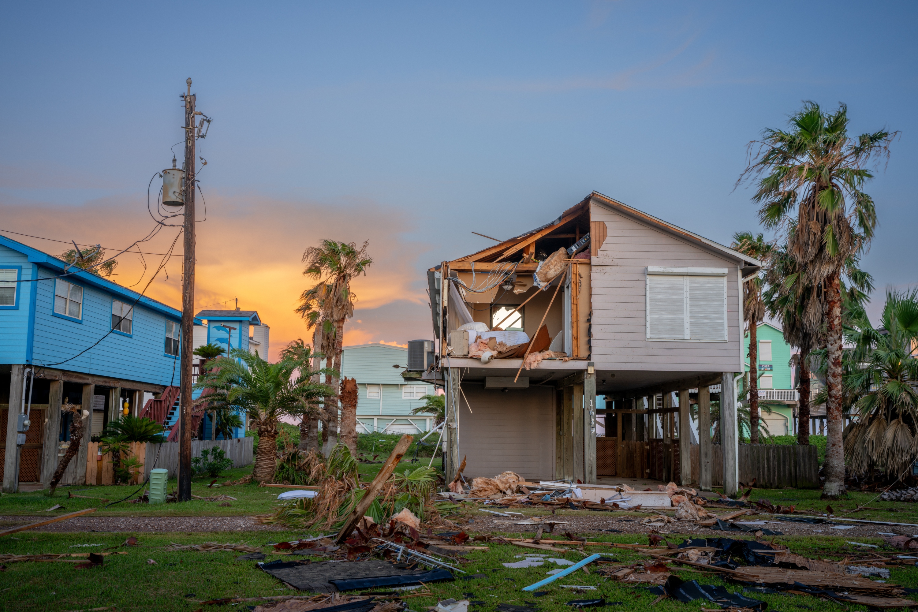
In North America, the Mississippi Delta has lost approximately 1,900 square miles in the last century. Levees prevent the river from naturally flooding and depositing sediment across the delta, leading to an average subsidence rate of two inches per year. This ongoing sinking exacerbates the delta’s vulnerability to storm surges during hurricanes.
The Po Delta in Italy is experiencing subsidence of between two and four inches per year, a consequence of losing 71 percent of its sediment supply to dams.
The Nile Delta, a critical agricultural region for Egypt, faces a dual threat from reduced sediment supply due to the High Aswan Dam, constructed in the 1960s, and extensive groundwater pumping for irrigation. The new analysis reveals subsidence rates "much bigger than previously reported, with millions of people in harm’s way." This has led to coastal erosion in places exceeding 300 feet per year, engulfing farmland, threatening the historic city of Alexandria, and contaminating underground water sources with saltwater.
Implications and Urgent Need for Action
The combined findings of these two studies present a stark reality: the threat of coastal inundation is far more immediate and widespread than previously believed. This underestimation has created a dangerous complacency among policymakers and planning agencies, particularly in vulnerable regions with limited resources.
"The sea level baseline is higher than assumed, the land is sinking in many critical regions, the sea is rising faster, and extreme events now come on top, producing impacts that are greater than the sum of their parts," warned Ghomsi, summarizing the dire situation facing countries in Southeast Asia and Africa.
However, the dominant role of land subsidence in many coastal flooding scenarios also presents a potential avenue for mitigation. While rising sea levels are a consequence of global climate change and require concerted international action, land subsidence can be addressed through localized measures. Scott Jasechko, a hydrologist at the University of California Santa Barbara and author of a recent global study on groundwater recovery, noted that "subsidence can be stopped quickly by local action, such as ending groundwater pumping."
Examples of successful interventions exist. Tokyo, which experienced up to 15 feet of subsidence between 1920 and 1960 as it grew into the world’s most populous metropolitan area, largely halted groundwater pumping and has maintained stable land levels since. In the Mississippi Delta, the U.S. Army Corps of Engineers has begun diverting sediment-rich water to restore protective coastal marshes, a measure initiated after Hurricane Katrina highlighted the delta’s vulnerability.
Despite these potential solutions, the scale of the problem is immense. Governments and aid agencies must rapidly integrate the new understanding of actual sea levels and subsidence rates into their planning. Without immediate and targeted interventions, millions more people will face displacement and loss as coastal communities are increasingly swallowed by the rising and sinking lands. The time for reassessment and decisive action is now, before the tide of these underestimated threats becomes insurmountable.


